Finding solutions to address our community’s long-standing housing challenges has been a significant focus of many City departments, volunteer committees, and the Council and Mayor for a number of years. The Office of City Planning has supported these housing action plans and a number of zoning changes related to housing for nearly a decade. While many of zoning changes have focused on areas identified for more significant growth in planBTV—the downtown and other denser, mixed-use areas—the focus of the Neighborhood Code is on how to create new neighborhood-scale housing options within residentially-zoned areas.
This webpage provides in-depth responses to frequently asked questions about the proposed changes, as well as links to videos that dive into the purpose of the code, recommendations, and changes to existing residential zoning district boundaries.
Watch the Neighborhood Code Video Series
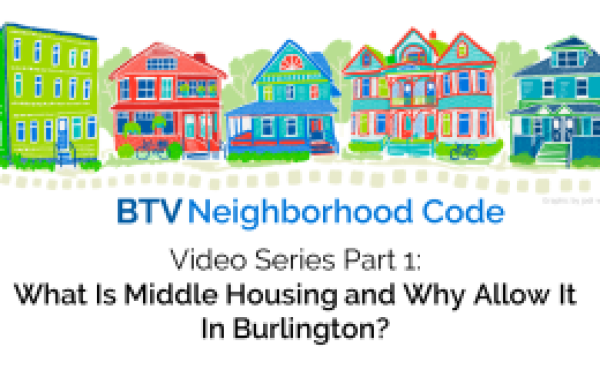
What is Middle Housing + Why Allow it in Burlington?
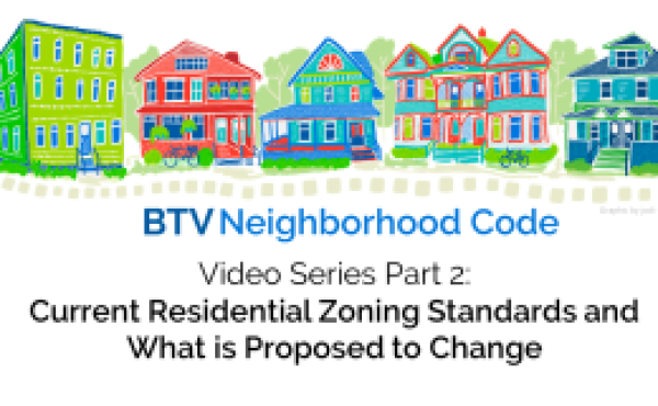
Residential Zoning Standards + Recommendations
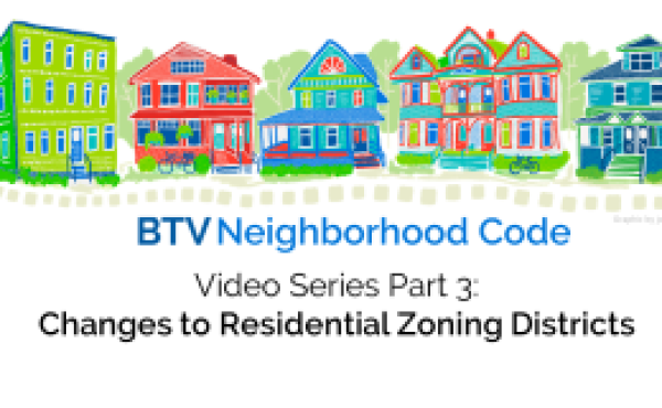
Changes to Residential Zoning Districts
Frequently Asked Questions
Lot Cover + Setbacks
Why have lot cover limits?
Lot coverage refers to the amount of a lot that is covered by impervious surfaces—primarily buildings and driveways that do not allow stormwater to percolate into the ground. They can be an important factor in helping manage stormwater. In some areas of the city, subsurface conditions and other infrastructure factors may be conducive to stormwater being managed in smaller amounts of impervious area, while other areas may require more open areas to allow water to absorb. There are also ways that certain intentionally-designed landscape systems and other engineering solutions can allow stormwater to be managed in smaller “green” spaces as well as in “paved” spaces. Lot cover limits can also help guide our perception of development patterns in terms of the relationship between building area and open space.
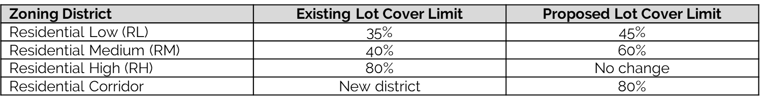
Proposed Changes to Lot Cover Limits
The Neighborhood Code recommends modest increases to allowable lot coverage limits in Residential Low (RL) in order to allow homes to be created on existing or new small lots, and Residential Medium (RM) to support additions to existing buildings and lots where lot coverage already often exceeds the current limits. No changes are recommended for the current Residential High (RH). The code also proposes a new Residential Corridor (RC) district, which would be similar to the RH zone, allowing for new residential development types along the Colchester Avenue, North Avenue, and Shelburne Road corridors.
Background
These recommendations are based on a study of the existing lot coverage data available and how new homes could be added in different areas of the city. In some cases, the proposed changes are informed by lots in these existing or proposed zones that have already been built. For example, in the western portion of the Old North End, which is currently zoned RM, more than half of the properties in this neighborhood are already built out with more than 60% lot cover today. This issue was first identified in the City’s work to allow more Accessory Dwelling Units (ADUs); due to this misalignment, a lot coverage exemption was included in the new ADU rules to ensure that certain neighborhoods wouldn’t be effectively prohibited from having ADU’s. The neighborhood code seeks to address some of this misalignment, so that fewer special exceptions are needed.
We have heard a number of questions about the impact on areas that are proposed to be changed from RL to RM zoning. There are five areas proposed to be rezoned from RL to RM, in which half or more of the properties are already built out with more than the 35% lot coverage allowed under today’s zoning, and also the 45% lot coverage that would be allowed under the new RL rules. For example, in the Five Sisters neighborhood, approximately half of properties are already over 45% lot cover (the proposed rule for RL) and almost a quarter are over 60% lot cover (the proposed rule for RM). This is an example of a neighborhood where the proposed changes to the lot cover rules, and the proposed changes to the zoning map for districts, would have an incremental change. Based on what we know about when this area was developed, it’s likely that many of the lots were built out before the current zoning rules were in place. It is an example of a popular neighborhood that has a mix of properties with lot cover in the range recommended by the Neighborhood Code that also includes yards, robust landscaping, and mature trees.
Lot Cover Flexibility for Accessibility Features & Pervious Paving
We’ve heard questions about ensuring the code allows for features like ramps and walkways that allow properties to be accessible for people for people of all physical abilities. The current code allows for an additional 10% of lot cover in RL & RM zones for features that are common on residential lots—such as walkways, ramps, decks, and areas of a lot that use pervious paving. The Neighborhood Code proposes to keep this, and also allow this additional lot coverage to be used for driveways—but only if the driveway is constructed from pervious paving systems that are approved by the Stormwater Division at the Department of Public Works (DPW).
City Planning and DPW recognize that creating more housing opportunities within areas of the city that are already developed is a key part of meeting the city’s housing challenges, and is a way that Burlington can do its part to help reduce demand for new development in ecologically sensitive areas within and outside of the city that impact our broader environmental resources. At the same time, these teams also recognize the need and opportunity to strengthen planning coordination and specific tools to help manage stormwater impacts in certain locations around the city.
In addition to the City’s standalone stormwater regulations (often referred to as Chapter 26), zoning changes in recent years support more intensive infill in locations that are already developed—such as downtown, on brownfields, and on surface parking lots in the newly-created South End Innovation District. These zoning changes included geographically-specific requirements or incentives for new development to be designed in a way that improves the existing condition for stormwater, and the city’s development review process for these major projects provides an opportunity for DPW to review and require site-specific stormwater solutions.
Recognizing that increased density in the combined sewer system presents unique challenges due to both the potential increase in stormwater runoff and wastewater, DPW has developed and is adhering to an interim combined sewer offset policy. This requires projects that exceed a certain threshold of wastewater discharge into a sewer line that receives both stormwater and wastewater, would be required to provide extra on-site mitigation for stormwater (beyond Chapter 26’s authorized requirements) to offset the impact of new wastewater flows and preserve pipe and wastewater plant hydraulic capacity.
In addition to the discussion of lot cover above, it is important to put into context that while the proposed changes to lot cover for the Residential Low (RL) and Residential Medium (RM) zones will allow infill buildings where they have not been allowed in recent decades, they will not be allowed at the same intensity of development as locations such as downtown or in the new South End Innovation District.
The Neighborhood Code is focused on developments of a much smaller scale which could be enabled in small projects throughout the city rather than in a single concentrated area, and can likely utilize existing built infrastructure. This could include new homes on smaller lots, buildings in rear yards, or additions to existing buildings. Additionally, it could enable new homes by renovating existing buildings that are not currently residential today or by building on top of existing impervious surface without adding new lot coverage. It is important to note that based on stakeholder input in the development of the proposed code, the city’s experience with changing its rules to encourage ADU creation, and experience in other communities with similar zoning changes to the Neighborhood Code, new development resulting from the neighborhood code is expected to be incremental.
That said, existing zoning permit requirements and Chapter 26 mean that any development that disturbs 400 sq.ft. or more of site area (an area smaller than a common 2-car garage) is required to be reviewed by the Stormwater Division at DPW. Smaller residential projects involving the addition or redevelopment of impervious surface currently may also be required to submit a Residential Stormwater Management questionnaire. These reviews provide an opportunity to determine any applicable stormwater management requirements or best practices based on individual sites and the conditions within that part of the city. Additionally, within residential districts, the creation of either 5+ units in RL areas, or 10+ units in all other residential districts requires more requires detailed cross-departmental review during the development review process, including for stormwater management and potential impacts on other infrastructure.
In addition to the site-specific tools for stormwater review above, DPW and Planning are discussing additional ways that the city can increase capacity for and coordination, including managing the cumulative impacts of growth on stormwater without burdening existing ratepayers. DPW is currently studying models for impact fees or payments in lieu of on-site mitigation that could support existing and future publically-managed stormwater infrastructure or incentives for retrofits on private property. The city teams are also considering ways that upcoming collaborative planning efforts can create stronger links between neighborhood planning, infrastructure capacity, and future zoning changes.
Separate from private development, public investment in Green and Grey Stormwater infrastructure in the city’s combined sewersheds has resulted in an overall decrease in the number of combined sewer overflows (CSO’s). These include targeted work by DPW to monitor and actively remove blockages, build stormwater storage tanks, and expand both surface and subsurface infrastructure to support stormwater management, such as in the St. Paul Street and City Hall Park construction projects. You can learn more about how CSO’s have decreased on the City’s CSO dashboard.
Existing rules regarding front setback standards are flexible, and based on the average setback of buildings on neighboring properties. This is meant to guide one of the most observable elements of a neighborhood’s built pattern—how close buildings are to the public realm. The current standards provide a flexible approach that is hyperlocal to a building’s surroundings.
Based on our team’s study of lots across the city, and consideration of the most realistic ways infill could occur in neighborhoods, we do not believe the front setback requirement poses a major barrier. Additionally, replacing the current standard with a set distance, such as proposed for rear setbacks, would require a fine-grain approach to assigning residential districts across the city. Front setbacks range from as small as 5 ft or less in some older neighborhoods in the city to 25 ft or greater in others.
Building Size + Number of Units
The Home Act (also known as Act 47 or S.100) requires municipalities to allow duplexes by right, with rules that are no more restrictive than for a single family home. It also requires municipalities in areas with sewer and water service (such as Burlington) to allow 3 and 4 unit buildings by right wherever residential uses are allowed, and there is a base density standard of 5 units per acre that must be met.
While Burlington does allow for 2, 3, and 4 unit buildings in RM and RH zones today, we do not allow 3 and 4 unit buildings in RL and we require nearly double the lot size to have a duplex in RL as is required for a single-family home. By allowing up to 4 units per building, without different lot size requirements for different building types, we are meeting the Home Act’s rules for duplexes and allowing 3 and 4 unit building in residential areas, and are being more permissive for lots that could allow 3 and 4 unit buildings are allowed that the minimum required by state law.
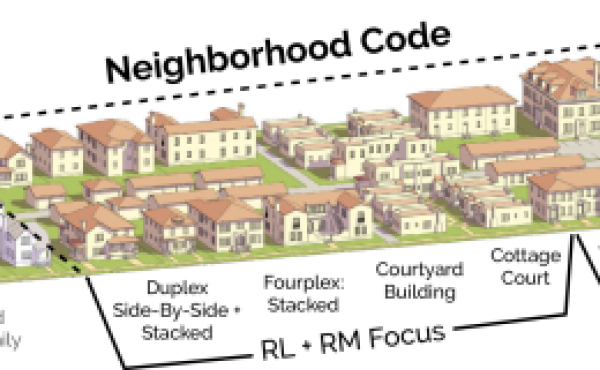
The purpose is to allow flexibility for how more of the middle housing types could be accommodated citywide. The code allows new homes to be created in a single building, an addition to an existing building, or in a new building behind or on the same lot as an existing home.
There are many different challenges and opportunities to creating new homes citywide, based on different lot sizes, existing development patterns, proximity to public transportation and other walkable destinations, etc. For example, we didn’t want to foreclose the opportunity that a new building in the rear of a lot behind an existing home, rather than replacing the existing home, could be a good solution in some locations.
Other factors such as the location and size of an existing building on a lot, lot coverage, setbacks, required distances between buildings on the same lot, minimum unit sizes, the number of parking spaces provided, whether the building is required to have sprinklers, and the financial realities of new construction and renovation in the city will all impact the feasibility of whether a lot could accommodate two buildings, and whether those buildings could have the maximum number of units.
The size limits for Primary and Secondary buildings refer to the ground floor of a building only. The neighborhood code limits the footprint of a primary building to 1,800 sq.ft. If there is a second building on a lot, the footprints are more limited—at 1,100 sq.ft. in RL and 900 sq.ft. in RM.
These were recommended based on a review of both the housing types the Neighborhood Code aims to enable (meaning the likely building dimensions of a duplex or a small row of townhouses), the size of existing buildings and lots in neighborhoods across the city, and whether the building size could accommodate a range of unit sizes within buildings (including multi-bedroom units, not just small studio units). The code proposes to allow the Primary building to be larger than a Secondary building to support new and rear buildings having a smaller size for their context.
While not a perfect comparison, it may be helpful to know that state law requires the city to allow Accessory Dwelling Units (ADUs) to be 900 sq.ft. or 30% of the size of the primary home, whichever is greater.
Big Picture Questions
Based on stakeholder input in the development of the proposed code, the city’s experience with changing its rules to encourage ADU creation, and experience in other communities with similar zoning changes to the Neighborhood Code, new development resulting from the neighborhood code is expected to be incremental. The Neighborhood Code is expected to generate hundreds of new homes citywide over the next decade plus—as compared to other recent zoning changes that could enable hundreds of new homes in a single area in that same time.
That said, housing development in Chittenden County has been shifting further out, contributing to sprawl, and creating more complex challenges for managing transportation systems and other infrastructure. Conversely, through incremental infill, the Neighborhood Code aims to create opportunities for new and diverse housing types within existing neighborhoods, where residents will be able to utilize existing infrastructure, spread the demand for infrastructure services throughout the city, and incrementally increase tax revenue to support these services. Given that Burlington is a landlocked and that nearly 40% of that land area is protected as important natural, open and recreation spaces, increasing the number of homes in areas already developed is key to both addressing housing needs as well as better utilizing infrastructure and increasing the tax potential.
Upcoming neighborhood planning studies for the New North End, ongoing work to plan for development resulting from the recent South End Innovation District zoning changes, and the Planning office’s participation in long-range plans of other departments provide opportunities to strengthen coordination between zoning changes like the neighborhood code and plans for other areas and systems in the city.
Additionally, since the mid-1990’s, the City has collected impact fees on projects which create new housing units and new non-residential area. These fees require new development to pay a share of the cost of needed expansions in municipal and school capital projects that would benefit them. These fees have been collected to support Parks, Library, Schools, Police, Fire and Traffic. The Planning office is currently working with other city departments to update its plan for capital improvements and the overall fee amount collected through this tool. Additionally, current work underway on the FY25 budget is exploring other opportunities to identify non-property tax revenue sources to supplement existing sources.
Additional Resources:
Want to stay informed about Part 2 of the Neighborhood Code?
You can sign up for email updates using the online form below:
BTV Neighborhood Code is supported by a Bylaw Modernization Grant from the VT Dept of Housing & Community Development, and in collaboration with and in-kind support from AARP-Vermont's Livable Communities program.
About the Joint Committee Process
Learn more about how the Neighborhood Code was reviewed through a Joint Committee Process
Neighborhood Code Proposed Changes
Learn more about the proposed residential zoning standards & where those changes should apply.

About the Neighborhood Code
More information about the intent behind the BTV Neighborhood Code